Active fires across Borneo and Sumatra
See recent fire detections across Borneo and Sumatra, alongside orangutan range. Use the controls to explore by region and time.
Loading current satellite detections…
What does the smoke mean on the ground?
Satellite detections tell us where fires are occurring. Air-quality monitoring adds another part of the picture: what those conditions can mean for people living nearby.
This live reading comes from the Pangkalan Bun regional monitor near Tanjung Puting.
Data: World Air Quality Index Project BMKG / CWOP
Why is Indonesia burning again?
Indonesian authorities say human activity is a major cause of the 2026 forest and land fires. As of September 18, police had opened 219 criminal investigations and named 162 people as suspects. Police are also investigating 95 companies in connection with the fires. Many investigated fires involve land being deliberately burned for clearing, while prolonged dry conditions are making fires easier to spread and harder to extinguish.
Deliberate land clearing
- Most investigated 2026 cases involve intentionally burning cleared vegetation
- Fire is used because it is cheaper than mechanical land clearing
- Some cases involve land being prepared for oil palm and other plantations
- Investigators are still tracing who financed or ordered some burns
The impact extends beyond the burn
- Dry conditions make fires harder to control and extinguish
- Peat can continue smouldering after surface flames are contained
- Many separate fires can overwhelm regional firefighting capacity
- Smoke can travel far beyond the burned area and affect people and wildlife
A fire can outlast the flames.
When forest and peatland burn, the effects continue after the flames are gone. Orangutans can lose feeding trees, nesting sites and safe canopy routes, while people across the region can face prolonged smoke exposure, disruption and an increased risk of premature death. Wildlife that escapes the fire may still face displacement, hunger and degraded habitat afterward.

Peat can keep burning below the surface.
Many important orangutan forests in Borneo and Sumatra grow on peat. When peat is drained, it dries and becomes much more vulnerable to fire. Unlike a surface burn, peat can smoulder underground and be difficult to extinguish.
Repeated burning also changes the forest itself, making future fires easier to start and harder for the original ecosystem to recover from.
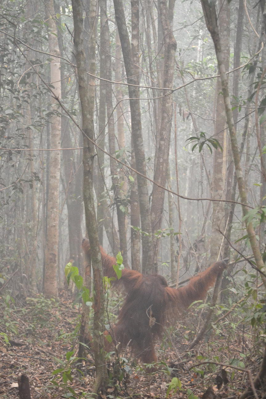
Smoke affects orangutans that survive the fire.
A 2018 study at the Tuanan Research Station in Central Kalimantan followed four adult flanged male Bornean orangutans around the severe 2015 fire season. During and after the smoke period, the animals rested more, travelled less, and later showed evidence of increased fat use. The researchers concluded that wildfire smoke negatively affected orangutan condition, while noting the study’s small sample size.

How to read the map.
Satellite detections show likely fire activity, not exact burned areas. Cloud cover, smoke and satellite timing can cause some fires to be missed.
Aerosol optical depth measures particles in the atmosphere, so elevated values can reflect wildfire smoke but can also include dust and pollution. The orangutan range overlay is generalized and should not be read as an exact habitat boundary.
See More of the Picture
Fire is one part of a connected habitat crisis that also includes forest conversion, fragmentation, mining, plantations and conflict with people.
Explore Orangutan Threats- Habitat loss
- Palm oil plantations
- Illegal wildlife trade
- Human-wildlife conflict
- Mining and roads